IFARM (Imaging For Agricultural Research and Management)
Primary tabs
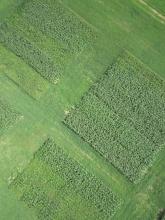
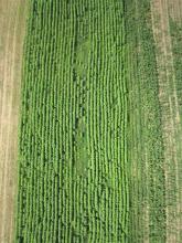
Remote sensing has been successfully used in research at the landscape scale and for large scale production agriculture; however, cost and low resolution has made this technology impractical for smaller producers and for field or plot-scale research. Now, recent advances in digital imaging technology mounted on unmanned aerial vehicles (UAVs) and balloons, and kites has made high resolution monitoring of agricultural production operations and research plots feasible and inexpensive (individual systems cost as low as $200). This technology has immediate application to agricultural practices that are data intensive or time sensitive, such as adaptive nutrient management. Additionally, these aerial low cost imaging platforms may reduce the labor, time, and equipment costs of biomass data collection, one of the primary factors limiting on-farm research. This tool aims to demonstrate the technology in the field, and refine the techniques for data acquisition and interpretation, including identification of crop plant and weed species spectral signatures, biomass, crop height, and percent cover , as well as identification of crop stress signatures.
UAVs balloons and Kites can be used to generate rapid and accurate crop plant performance datasets for on-farm management and field and plot-scale research. It will be necessary to calibrate and test the accuracy of remotely sensed data with on the ground methods such as spectrometer calibrated targets and manually gathered ground truthing observations that document percent cover, biomass, spectral signatures, soil conditions, species indentity and mixture as well as other observations. The calibration process will roughly parallel the on-the ground verification and calibration process of satellite based remote sensing technologies, but at a much higher resolution and using distributed volunteer efforts to build the libraries.
iFARM Public Lab research notes from the 2012-2014 events can be found here http://publiclab.org/tag/ifarm
iFarm Structure and tool development planThe following structure is proposed to organize the many elements required to develop quantitative analysis from imagery. Additional tools and wikis will be linked through this menu to simplify this tool, but also to add more depth to the wiki structure.
Aerial Imagery o kites (links to examples) o balloons (links to examples) o fixed wing conventional (links to examples) o flying wing (links to examples) o multirotor (links to examples) o other (hybrid, blimp, powered kite etc.) (links to examples)
Support Community o Public lab o DIYDrones o Flight Riot o Ecosynth o Conservation Drones o Drone mapper o Commercial providers
Ground truthing methods o Ground based wireless network and data logging • color calibration • ground sensor networks • Wifi based sensor networks (commotion and ubiquity hardware etc) • Xbee based wireless networks • Sensor technology – and approaches, costs etc. Traditional methods
Imaging
CHDK, multispectral/NDVI, Lidar, Thermal Imaging, low cost lidar,
Post Processing
o Georeferencing o Stitching o VSFM o color and texture analysis o crop height calculations, leaf area index, percent cover, biomass volume o Imaging and Neural network pattern recognition
Observation Kits concept meaningful "kits" of hardware and software to observe particular indicators Some areas that can be addressed with imaging
- Crop type
- Plant count
- Invasive species identification and quantification
- Canopy cover
- Leaf area index + Soil type
- Soil moisture
- Growth stage
- Plant Height
- Nitrogen deficiencies
- Plant health
- Detasseling
- Yield Monitoring
- Biomass
- Forest health
- Disease detection
- Land cover mapping
- Carbon Mapping
- Irrigated land mapping
- Impervious surface mapping
- Watershed planning
Types of imaging VISUAL SENSOR + High resolution, low distortion camera (RGB) Ideal for: + Aerial mapping and imaging + Photogrammetry and 3D reconstruction + Plant counting + Surveying and land use applications LIDAR SENSOR + Short range, 270° scanning LASER rangefinder + Useful in 3D digital surface modeling, stockpile calculation, surface variation detection + Penetrates through vegetation: It can perform plant height measurements by collecting range information from the plant canopy and the ground below THERMAL INFRARED (TIR) SENSORS Microbolometer thermal sensors are best utilized in: + Heat signature detection + Livestock detection + Water temperature detection and water source identification MULTISPECTRAL SENSORS Multispectral sensors are used widely in: + Plant health measurement + Water quality assessment + Vegetation index calculation + Plant counting
Publishing and data export
KLM export and web hosting for GIS data files and export to adaptive farm management software and reports
Other related CommunitiesThe following organizations provide instructions and community support for open source aerial imaging http://grassrootsmapping.org/ http://publiclaboratory.org/home http://diydrones.com/ http://conservationdrones.org/ http://flightriot.com/ http://ecotope.org/projects/ecosynth/ iFARM was coined by Chris Fastie http://publiclaboratory.org/people/cfastie Examples of Images
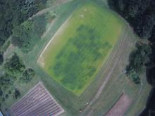
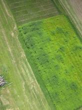
Embed Sample image Galleries here
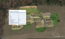
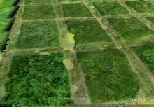
Google Earth also enables embedding gadgets to display KMZ tours of geolocated images and data
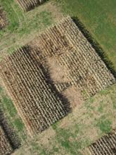
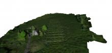
Organic Hairy Vetch plots aerial imagery imported into google earth
How it worksPublic Laboratory's open source balloon hardware setup:
http://store.publiclaboratory.org/products/balloon-mapping-kit
Full construction and operation instructions and bill of materials for a fixed wing aircraft based can be found here http://conservationdrones.org/hardware/
Open Source Spectral analysis kit:
http://store.publiclaboratory.org/products/desktop-spectrometry-kit
Construction/how to build2013 Skywalker fixed wing Imaging platform layout and construction wiki is here http://farmhack.net/wiki/skywalker-2013-ifarm-mapping-setup Near Infrared Camera setups http://publiclaboratory.org/tool/near-infrared-camera http://publiclaboratory.org/tool/stereo-camera
Canon Powershots are often used because of the Canon Hack Developer Kit
Flight riot host instructional set up videos and lots of great open source resources for processing software http://flightriot.com/post-processing-software/
The following is for setting up a remote trigger http://flightriot.com/remote-sensing/trigger/
Additional information on knitting images can be found here
http://publiclaboratory.org/notes/cfastie/10-29-2012/agricultural-mapping
A poster about interpretation of NDVI and visual spectrum analysis can be found here http://publiclaboratory.org/notes/cfastie/10-29-2012/agricultural-mapping
MarketplaceDIY Infrared Photography Kit http://store.publiclab.org/collections/diy-infrared-photography Spectrometer http://store.publiclaboratory.org/products/desktop-spectrometry-kit Balloon Kit http://store.publiclaboratory.org/products/balloon-mapping-kit DIY Drone fixed wing http://code.google.com/p/ardupilot-mega/wiki/Get DIY Drone rotary wing http://code.google.com/p/arducopter/wiki/Purchase


